Meteonorm Software
Worldwide irradiation data
Typical years and historical time series - easily accessible with Meteonorm.
- + 30 Meteorological parameters
- + 36 Different export formats
- Easy user interface
- Historical timeseries

Typical years and historical time series - easily accessible with Meteonorm.
Meteonorm is a unique combination of reliable data sources and sophisticated calculation tools. It provides access to typical years and historical time series.
Eight years after launching version 7, Meteotest publishes Meteonorm Version 8. This upgrade includes mainly new and more current climate periods, better access to ongoing timeseries and updates of the software. The user interface of the desktop software hasn't been changed much. With the publishing of version 8 Meteotest stops the support of version 6 (2006).
The prices of the desktop software stay the same. We still offer discounts for multiple licenses, users of version 7 and for educational purposes.
Compared to the current version 7.3, Meteonorm Version 8 is based on more recent data from the following periods:
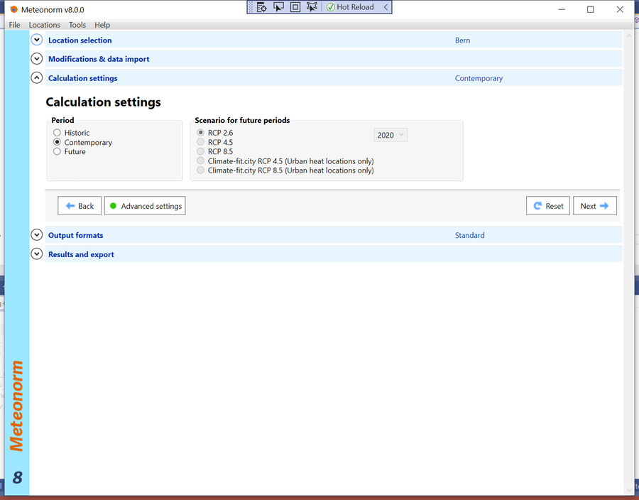
This recent time period is denoted in the new Version as “contemporary”. It is still possible to choose a “historic” data period (1981 – 1990 for radiation and 1961 – 1990 for temperature).Tell me more!
Meteonorm 8 allows access to historical time series of irradiation, temperature, humidity, precipitation and wind. The new archive contains hourly data since 2010 and is constantly updated. You can download these time series directly from the Meteonorm software.
Thanks to this feature, Meteonorm now offers access to all relevant meteorological information required for planning of solar applications through the same software platform: typical years, monthly averages, hourly time series.
Meteonorm generates accurate and representative typical years for any place on earth. You can choose from more than 30 different weather parameters.
The database consists of more than 8 000 weather stations, five geostationary satellites and a globally calibrated aerosol climatology. On this basis, sophisticated interpolation models, based on more than 30 years of experience, provide results with high accuracy worldwide.
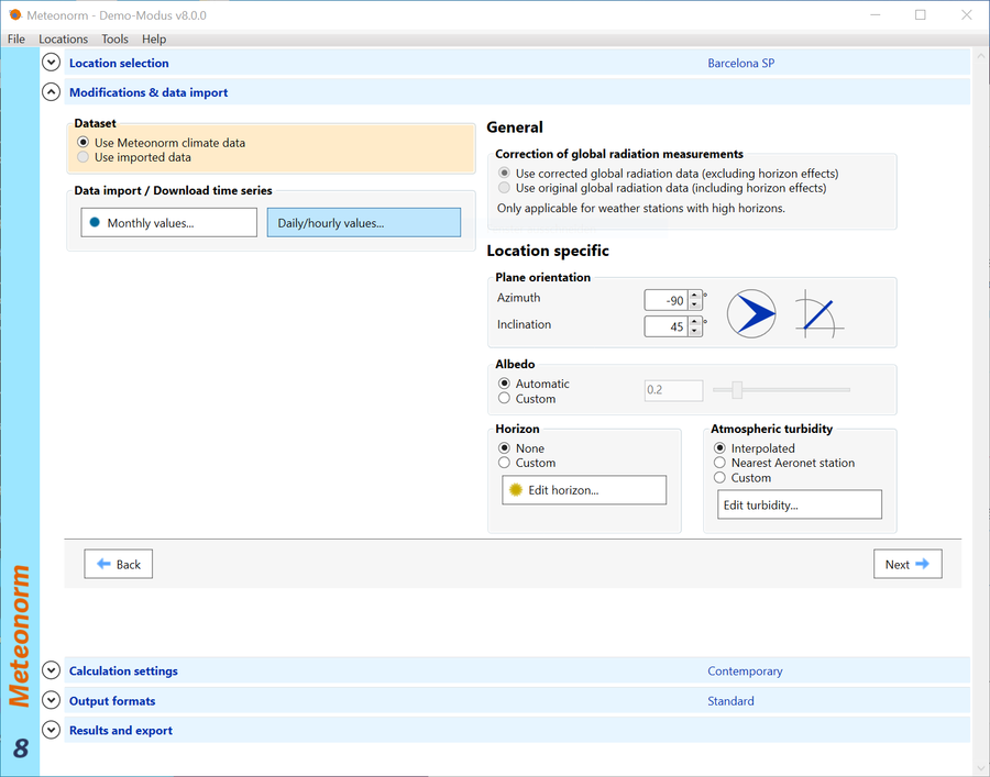
You can import of any third party data, be it from satellites or from measurement stations and still profit from all tools inside Meteonorm.
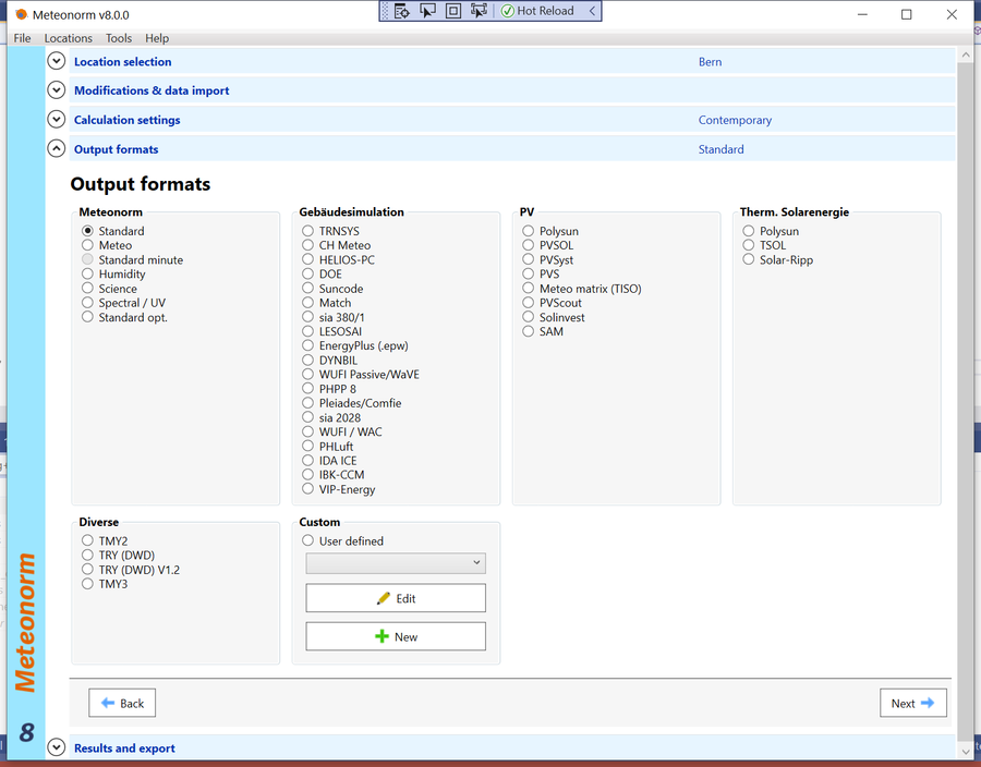
The intuitive desktop software lets you to easily manage your sites and retrieve the required results in a convenient and fast way. More than 30 different output formats offer maximum flexibility.
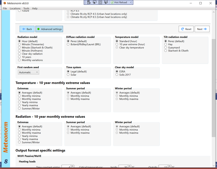
Meteonorm includes two of the best minute models on the market for reliable simulations of large PV plants or energy management & battery systems. It can model urban heat effects to support the development of green cities. It contains algorithms to calculate extreme years, for example to test design limits. You can even simulate Climate Change using IPCC scenarios.
The first version of Meteonorm was published as paperback handbook in 1985. Ten years later, Meteotest transferred the handbook to a desktop software. In 1998, the coverage of the climate data was extended from Switzerland to the whole world. The global breakthrough was reached with version 6 – back in 2007.
Today Meteonorm has more than 2 000 active users and is included in almost every PV, solar thermal or building simulation software on the market.
Meteonorm is not only a desktop software: For digital applications, our web service API and our Dynamic Link Library DLL ensure platform independent access to all data and models of Meteonorm, from everywhere. This allows the intergration of Meteonorm data in web applications, simulation software, building design software or building information modelling applications.
All this makes Meteonorm a global standard and a powerful tool for solar energy applications, building design, heating & cooling systems, education, agriculture, forestry and many more.
Our Solar Web Service products SolarForecast, CloudMove and SolarSat provide you with accurate irradiation forecasts for the next hours and days. Learn more on the website or have a look at the live demo!
Data from more than 8 000 weather stations worldwide and five geostationary satellites.
The standard periods are 1996–2015 for irradiation data and 2000–2019 for all other parameters.
Meteonorm generates monthly, daily, hourly and minute values.
Historical hourly values of irradiation, temperature, humidity, wind and precipitation from 2010 to present, constantly updated.
36 output formats: CSV, TMY2, TMY3, EPW, PVSol, PVSyst, Polysun, SAM and many more.
Interpolation models calculate typical years for any location worldwide.
Globally calibrated gridded dataset by Chris Gueymard. Time period 2000-2015, spatial resolution 0.5°.
The Meteonorm core is also available as Dynamic Link Library or Web Service for digital applications.
Current monthly values can be accessed online directly from the software.
Transparent information on data sources and uncertainty provided for each data set. Validation papers available on the website.
Urban heat islands can be simulated. Specific urban climatologies for Bern and Vienna.
Meteonorm includes three IPCC scenarios and allows projections to the year 2100.
Global 90x90m terrain model. Digitising tool for user-defined horizon lines.
P10 and P90 values available for simulating extreme years.
Third party data can be imported.
More that 30 different meteorological parameters available.
Europe
North America
Central/South America
Asia (with Russia)
Africa
Australia and Oceania
Satellites
World
Weather stations with well-maintained good quality instruments still provide the most accurate data for solar irradiation. They represent the ground truth, which is the relevant parameter for solar energy applications. But weather stations are not always located in the vicinity of the project site and time series may be incomplete.
In this context, satellites have become a valuable source for solar irradiation data, in particular in areas with sparse distribution of met stations. However, this approach also includes disadvantages such as lack of other meteorological parameters, uncertainties in aerosol values, detection of multiple cloud layers, inaccuracies in areas with snow or no data north of 62°.
There is no standard rule which option is the best one. We always recommend combining multiple data sources of ground and satellite data to achieve the lowest uncertainty for resource assessment. Meteonorm includes weather stations and satellite data
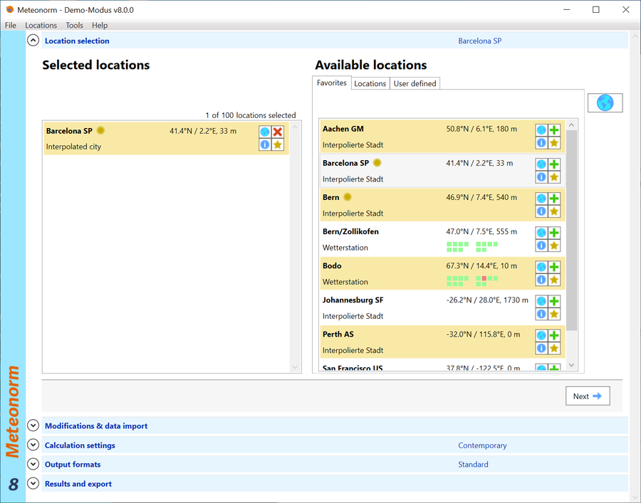
6 simple steps lead you to irradiation data for every place on Earth!